
Read the route in separate sections
A drive into the northern Daintree combines the ferry approaches, river crossing and road towards Cape Tribulation. Continuing farther north adds the Bloomfield Track, with different vehicle and weather considerations. A notice about one of these sections should be matched to your actual route before you change the whole trip. Equally, the absence of a notice in this dated overview is not a reason to ignore a barrier or instructions on the road.
The information date here is 3 November 2026. Use it to understand the works, then consult current Douglas Shire Council road and Daintree Coast notices and QPWS park alerts before departure. Revisit that decision after heavy rain. Leave room to shorten your programme or change the day rather than relying on a planned opening date as permission to drive through a work site.
Our picks: a guided journey
This two-day guided combination includes Cairns transfers and a cable ferry crossing on the rainforest day.
Hand-picked tours, booked through GetYourGuide. Prices are indicative starting prices in Australian dollars (as of October 2026). Tap a tour for live availability and the current price in your currency.
Two days of Daintree and Outback activities
Cairns transfers, rainforest walking, the ferry and a Chillagoe Caves visit form an organised programme, with accommodation separate.
Ferry approaches and the replacement project
The Council update of 7 October 2026 described the new southern ferry lanes as paved. Resurfacing of the old lanes was planned from 12 October 2026. On the northern side, the update described road, parking and footpath works. These are dated descriptions of the project and its schedule; follow the traffic management in place when you travel and allow extra time on both approaches.
The ferry crossing takes about 15 minutes including loading and unloading, with queueing additional. Work on the approaches can therefore matter even when the crossing itself is short. Keep a booked activity or an airport return comfortably apart from the ferry leg. The ferry planning page covers fares, ticket validity and downloading a QR code before reception becomes unreliable.
The change of operator on 1 July 2026 did not mark the arrival of the replacement vessel. Council plans delivery and commissioning of the larger new ferry for late 2027, including a temporary interruption for ramps and commissioning. The exact future interruption dates are still to be settled. Treat late 2027 as a project target and consult operating notices for the journey you are actually making.
Noah Creek Bridge and rain-related access
The 7 October 2026 Council update recorded that heavy rain had flooded the Noah Creek bypass temporarily and prompted a safety closure. It also described restoration of the piling pad. This illustrates why a route decision must account for recent weather as well as construction: a bypass mentioned in an earlier update is not a guaranteed alternative for a later day.
That update expected the bridge to open to vehicles in December 2026, with full project completion by June 2027. Both are planned milestones. They should not be read as an announcement that the bridge was already open on this page’s information date. For a drive towards Cape Tribulation, check the latest notice for the Noah Creek section and obey any closure or traffic management you encounter.
Alexandra Range and Noah Landslip
Investigations under traffic management were announced for 19 to 21 October 2026. Those dates had already passed by 3 November 2026, so they do not establish an active full closure for a November visit. The same Council update gave June 2027 as the target for Noah Landslip works. Keep the past investigation window and the longer works target separate when reading the route information.
If your programme depends on passing through the area at a particular time, check the current Council instructions before leaving your base. Allow space in the day for traffic management rather than calculating arrival solely from an uninterrupted drive. For your initial journey from CNS or Port Douglas, use the arrival and vehicle guide alongside the dated works information.
Bloomfield Track and your vehicle
QPWS describes the ferry to Cape Tribulation route as accessible by 2WD, with higher clearance helpful. Farther north, the Bloomfield Track is a 4WD route. Council describes it as only partly sealed, with steep sections and natural creek crossings. It is unsuitable for trailers, campervans and caravans, and rain can make it impassable. Choose a turning point that suits both your vehicle and conditions.
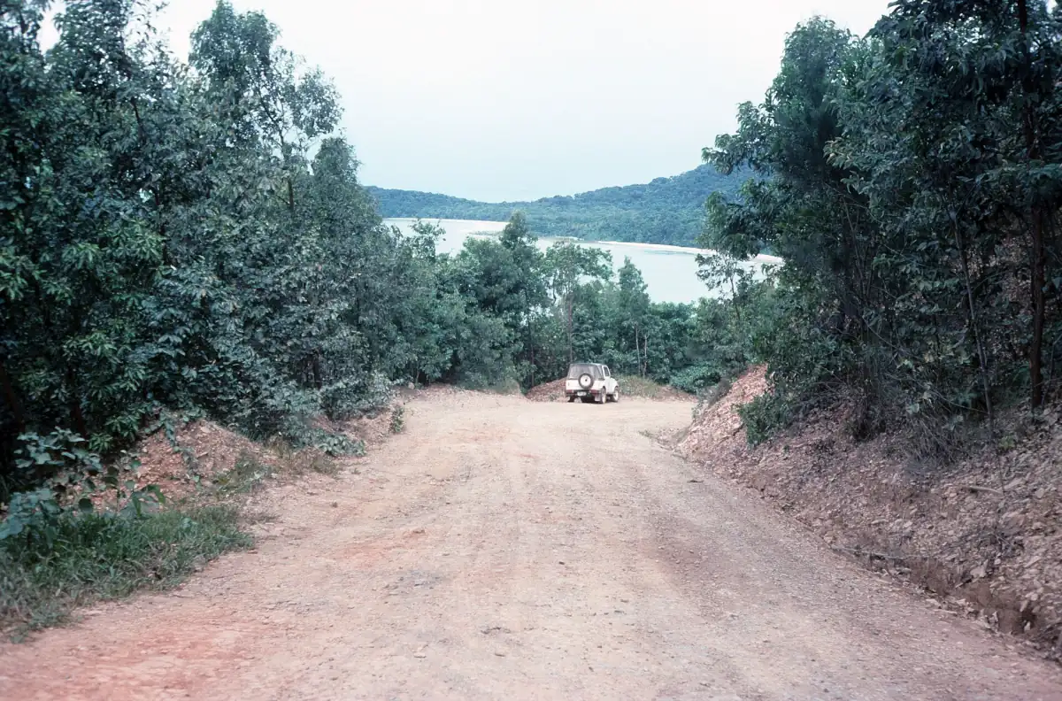
A 4WD vehicle does not settle the rental conditions. Check the current agreement for the exact road, geographical restrictions and insurance arrangements. Do not enter a closed road, and do not drive into a crossing merely because a map connects the endpoints. The historical road photograph on this page dates from 1989; use current notices and roadside instructions for today’s access decisions.
The official cyclone season runs from 1 November to 30 April, while QPWS describes December to April as the wetter period. Those seasonal descriptions are planning context, not a forecast for your date. Review weather warnings before setting out and keep important route details offline. Mobile reception is very limited; QPWS advises an additional emergency communication method, and the emergency number is 000.
Mossman Gorge
The park alert published on 30 October 2026 announces closure of the Rainforest Circuit from 9 November to 15 December 2026 for track improvements. This is a specific walking-track closure, rather than closure of the whole Daintree National Park or the Cape Tribulation road. Weather or construction issues may extend the period. For the southern park visit, continue to Mossman Gorge.
An organised rainforest and Outback combination
The featured experience combines two days of activities rather than providing a road bypass. Its inclusions cover Cairns return transfers, a driver-guide, a Daintree River cruise, a guided rainforest walk, the cable ferry crossing and lunch on both days. The Outback part includes a guided Chillagoe Caves visit. Accommodation is excluded, and Port Douglas or Northern Beaches transfers on the Outback day cost extra.
This format suits travellers who want the road journeys placed within an organised programme. It still operates within the same weather and access constraints as the region around it. Choose it for the activities and included arrangements, keep your accommodation separate, and leave flexibility around the two-day plan. Compare other rainforest tour formats if a single day is a better fit.
Frequently asked questions
Is Noah Creek Bridge already complete?
The 7 October 2026 update expected vehicle opening in December 2026 and full completion by June 2027. These are project targets; check the current road notice.
Can I take a campervan on Bloomfield Track?
Council describes the track as unsuitable for campervans, caravans and trailers. It is a partly sealed 4WD route with steep sections and natural creek crossings.
Does the November park closure cover Cape Tribulation?
The announced 9 November to 15 December 2026 closure concerns the Rainforest Circuit at Mossman Gorge. Match each separate road and park notice to your route.